Friends of The Mad River
  • Home
  • Our Impact
    • Community Climate Chats >
      • Past Climate Chats
      • Climate Survey
    • Ridge To River >
      • Action Framework >
        • Programs
        • Research Needs
        • Resources
      • Planning Process >
        • Team
        • Landscape
        • Planning
        • Community
    • Storm Smart >
      • Storm Smart Assessment
      • Storm Smart Resources & FAQs
      • Green Stormwater Infrastructure & Best Management Practices
    • Tree Planting
    • Keeping Water Local
    • Mad River Watch >
      • Highlights from the Field
      • Volunteer Resources
      • Historical Data
    • Flood & Fish Friendly Roads
  • Get Involved
    • Events
    • Volunteer
    • Learn
    • Donate
    • Jobs
  • Who We Are
  • News
  • Contact Us
  • #madshedlove

Keeping Water Local

Stormwater Master Plans - The Plans Come Together

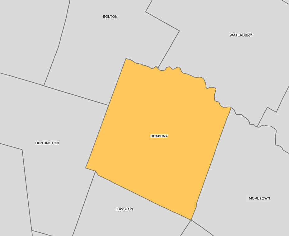
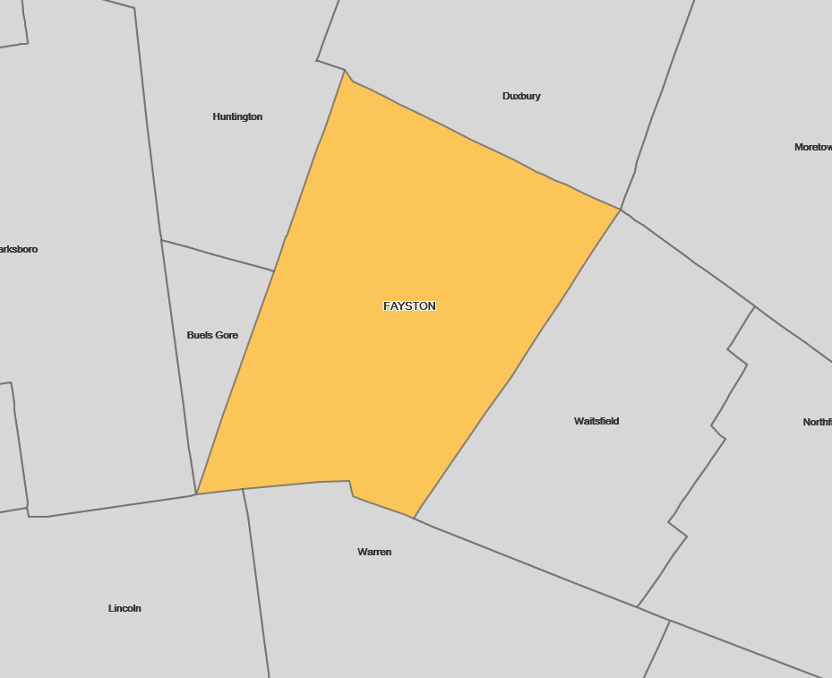
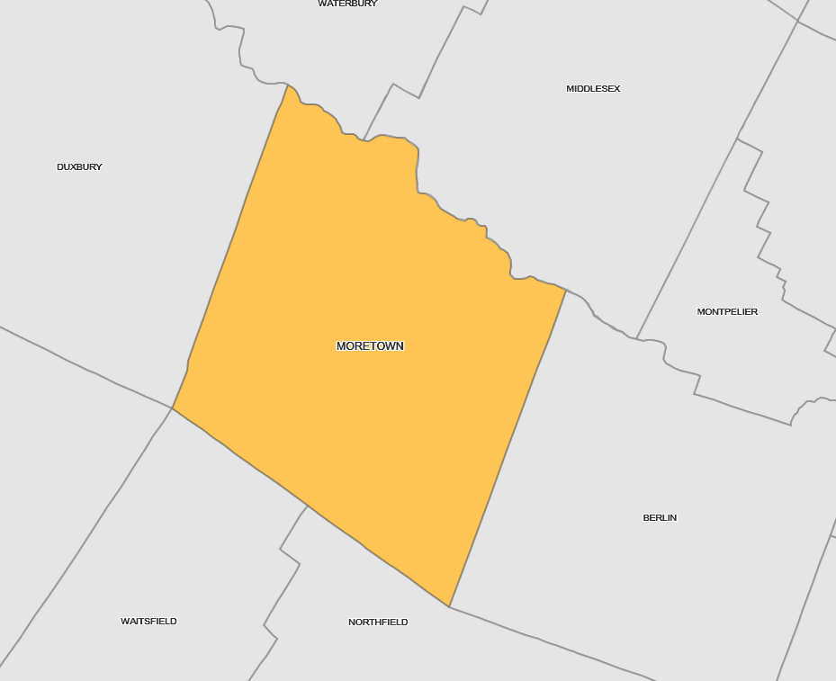
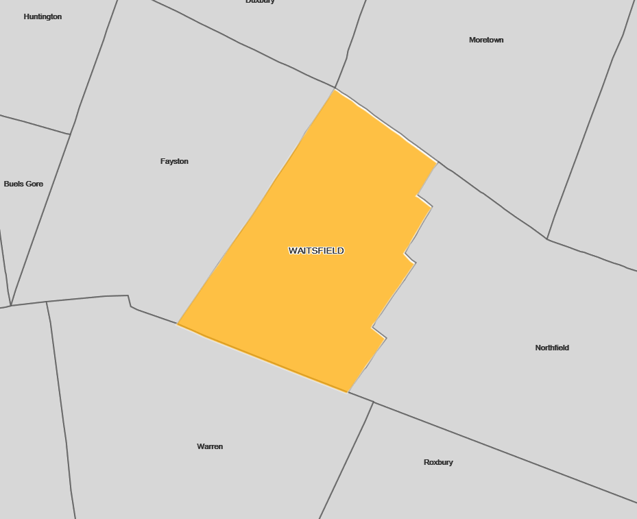
In May of 2019, the five Mad River Valley towns wrapped up a two-year planning process to advance stormwater management across the watershed, for its value to resilience and clean water. This "Stormwater Master Planning process" resulted in a watershed master plan, a list of 100 top projects (20 per town), and conceptual engineering plans for 25 priority sites (5 per town). Working with Friends of the Mad River, The Central Vermont Regional Planning Commission, Watershed Consulting Associates, and key town stakeholders prioritized opportunities in each valley town for slowing, sinking, and spreading stormwater runoff.
Get The Full Story In The Valley Reporter
Download the Watershed Stormwater Master Plan

Dive Deeper with Story Maps​

Picture


​Duxbury

Explore Duxbury's interactive Stormwater Master Plan Story Map and get a closeup look at what Duxbury can do to make a difference. Improving water quality and becoming more resilient in the face of big storms are at the heart of this plan. 
What's in Duxbury's Plan?

Picture


​Fayston

Explore Fayston's interactive Stormwater Master Plan Story Map and get a closeup look at what Fayston can do to make a difference. Improving water quality and becoming more resilient in the face of big storms are at the heart of this plan. 
What's In Fayston's Plan?
The Town of Fayston also partnered with Sugarbush Resort and Friends of the Mad River to produce a smaller scale stormwater master plan for the Chase Brook Subwatershed, around Mount Ellen. This resulted in  conceptual engineering designs for the top 3 sites.
What's In the CHASE BROOK SUBWATERSHED Plan?

Picture


​Moretown

Explore Moretown's interactive Stormwater Master Plan Story Map and get a closeup look at what Moretown can do to make a difference. Improving water quality and becoming more resilient in the face of big storms are at the heart of this plan. ​
What's In Moretown's Plan?

Picture


​Waitsfield

Explore Waitsfield's interactive Stormwater Master Plan Story Map and get a closeup look at what Waitsfield can do to make a difference. Improving water quality and becoming more resilient in the face of big storms are at the heart of this plan. ​
What's In Waitsfield's Plan?

Picture


​Warren

Explore Warren's interactive Stormwater Master Plan Story Map and get a closeup look at what Warren can do to make a difference. Improving water quality and becoming more resilient in the face of big storms are at the heart of this plan. ​
What's In Warren's Plan?

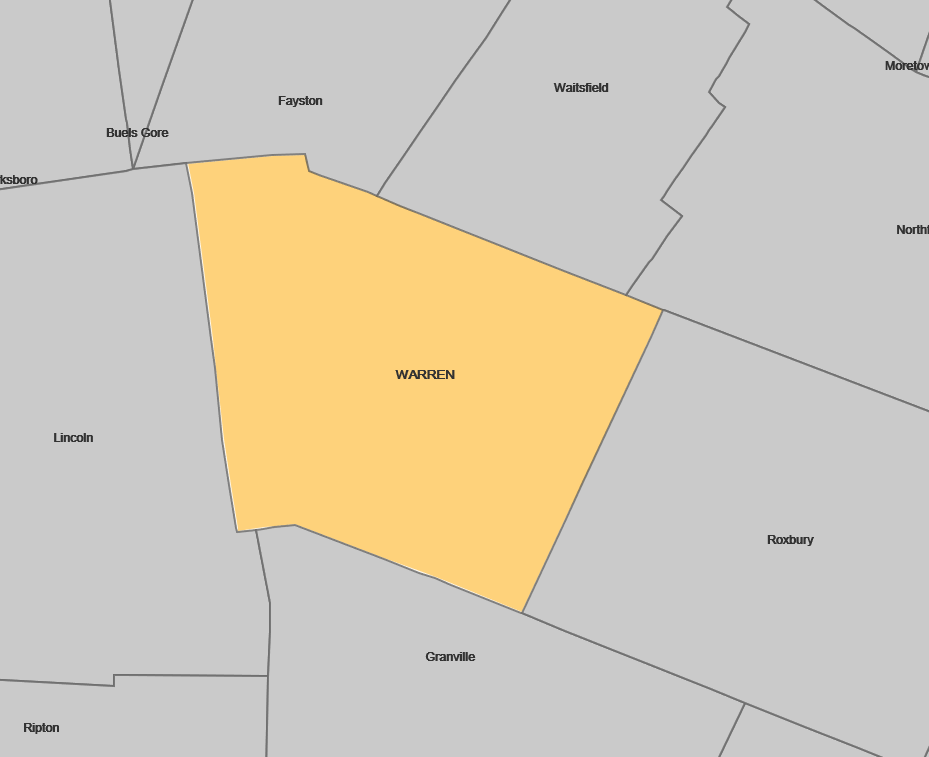
By completing the initial engineering designs for these priority sites, each municipality can now focus on securing funds for final engineering and project construction, which will help the state advance goals to reduce phosphorus loading and algae blooms in the Lake Champlain basin and help the Mad River Valley community be stronger in the face of worsening storm events.

Want to play a part in building the Mad River Valley community's resilience by better managing Stormwater?

Picture
Get a Storm Smart Assessment of your own property and find ways to slow down, spread out, and sink in stormwater before it can run downhill. Water that is absorbed where it lands is less likely to lead to costly erosion and flooding.
Storm Smart
Photo by Corrie Miller
Proudly powered by Weebly
  • Home
  • Our Impact
    • Community Climate Chats >
      • Past Climate Chats
      • Climate Survey
    • Ridge To River >
      • Action Framework >
        • Programs
        • Research Needs
        • Resources
      • Planning Process >
        • Team
        • Landscape
        • Planning
        • Community
    • Storm Smart >
      • Storm Smart Assessment
      • Storm Smart Resources & FAQs
      • Green Stormwater Infrastructure & Best Management Practices
    • Tree Planting
    • Keeping Water Local
    • Mad River Watch >
      • Highlights from the Field
      • Volunteer Resources
      • Historical Data
    • Flood & Fish Friendly Roads
  • Get Involved
    • Events
    • Volunteer
    • Learn
    • Donate
    • Jobs
  • Who We Are
  • News
  • Contact Us
  • #madshedlove